Web Mapping Applications (WMA) and Online Services:
- NEON Airborne Observation Platform (AOP) data acquired at the Kansas University Field Station (KUFS) WMA: https://ku.maps.arcgis.com/apps/webappviewer/index.html?id=65508da0ffcc461abfba22fa7b54cda7
- Potential Wetland Area (PWA) Database Dashboard: https://ku.maps.arcgis.com/apps/dashboards/168959bac666442fb155b50ffa813064
- Kansas land use/land cover: https://ku.maps.arcgis.com/apps/webappviewer/index.html?id=47a724e8a7aa43f58aaa9e07a9db99f5
- The Kansas Natural Resource Planner: https://ku.maps.arcgis.com/apps/webappviewer/index.html?id=5e392ceb40094cf18f028ef76ed3852a
- Flood Mapping Dashboard: https://ku.maps.arcgis.com/apps/dashboards/e28862d3853d4572990a3477ac2c18bc
- The Green Report: https://ku.maps.arcgis.com/apps/webappviewer/index.html?id=61e34817df3e49abb14df83cf0207167
For a full list of available services go to: http://services.kars.ku.edu/ArcGIS/rest/services/
Imagery and Data:
ESRI’s Access massive collections of satellite imagery with ArcGIS: https://www.esri.com/en-us/arcgis/products/unlock-earths-secrets
National/Global Imagery: https://www.usgs.gov/centers/eros
Data Access Support Center (DASC): https://kansasgis.org/catalog/index.cfm *Downloading data from DASC requires a user profile.
- Kansas Land Cover Patterns: Three land cover maps of Kansas are available. To access, click “Land Surface Geology Soils”

- Kansas Satellite Image Database (KSID): Three county-level data sets are available. To access, click “Imagery and Raster”
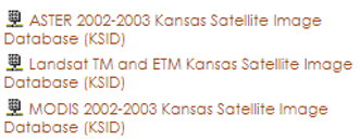
Image Gallery
