
KansasView is developing an ESRI Story Map describing the Kansas landscape and the Ecological Systems map that was recently created (see below). This mapping was a collaborative endeavor between the U.S. Fish and Wildlife Service, Kansas Department of Wildlife and Parks, MoRAP (Missouri Resource Assessment Partnership), and the Kansas Biological Survey. The Story Map will provide a backstory on the project, descriptions of the Kansas landscape, drivers of landscape formation and change. An interactive tour of the Kansas Ecological Systems has been created and include photographs representative of the vegetated landscape, a paired remotely sensed image (aerial or satellite), and photographs of flora and fauna, when available. The field data sites are displayed in an interactive WebApp with the land cover map as the base layer. Field sites are clickable to show a description of the field site including dominant vegetation species and a roadside photograph (Figure 9). More than 2,900 roadside photographs have been processed and attached to the point feature class of field sites visited. A description of the mapping approach will be included in the StoryMap avoiding technical and scientific jargon where possible. One goal is to educate GIS and non-GIS Kansans and beyond about the Kansas landscape, the new vegetation map product, and the basics of how the map was produced. Click here to view the story map: https://storymaps.arcgis.com/stories/90487a54e30e4362a6ac01006241e2c2


2022 NSF EPSCoR Summer Institute on the Ecosystems of Kansas
KansasView PI and Coordinator had the opportunity to participate in the Ecosystems of Kansas Summer Institute, where middle-school science teachers learned about bringing more geospatial data into their classrooms. Teachers competed in completing online satellite imagery puzzles, learned about AmericaView’s educational resources including other StateView ESRI StoryMaps, completed an ESRI GeoInquiries lesson, and learned about existing Web Mapping Applications (WMA) for Kansas related data.

KU News: https://news.ku.edu/kansas-science-teachers-explore-research-ku-field-station-week
Introduction to Drone Mapping
KansasView offered of a newly revamped course, Introduction to Drone Mapping, at the University of Kansas during the Fall Semester, 2019. Instructors included Dr. Dana Peterson and Dr. Stephen Egbert of KansasView, and Dr. Xingong Li. The overall purpose of developing the course was to create course materials and procedures that could serve as a model for developing similar courses at our partner, Haskell Indian Nations University, and other AmericaView institutions. The primary goals of the course were to give students hands-on experience in flying drones, collecting imagery, and processing aerial data to produce digital surface models, aerial mosaics, and related products.
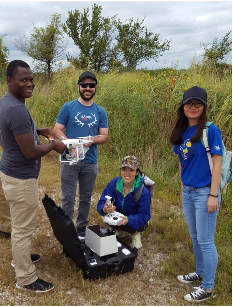
Specific teaching objectives included helping students understand (1) fundamental FAA rules for drone flights, (2) how to plan a drone aerial photography mission, (3) how to conduct safe flight operations, (4) how to use industry-standard drone mapping software, (5) useful drone apps, and (6) the range of potential drone applications. Class activities included in-class lectures, several sessions of drone flight and data gathering in the field, computer lab exercises, a guest lecture from a drone industry professional, and an independent research paper.
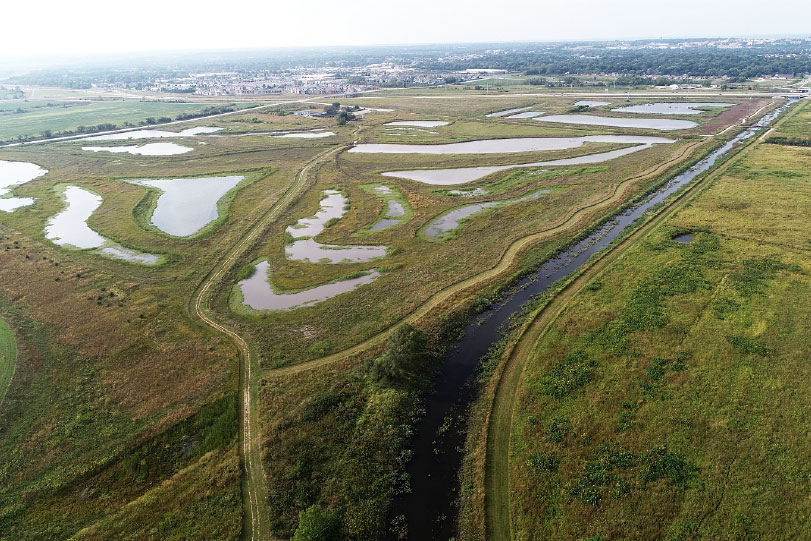
Course instructors had access to athletic practice fields at the University of Kansas for drone flight training and to the Baker Wetlands for drone mapping missions. Baker Wetlands is an extensive area of natural and restored wetlands lying in the Wakarusa River Valley just south of Lawrence, Kansas. The director of the Wetlands, Dr. Irene Unger, enthusiastically supported the use of the wetlands by the drone class, both for the value of the flight training and the resulting aerial photography that will be used for research and for promoting the value of the wetlands.
KansasView sponsors Haskell students at GPRM AAG 2019 Meeting
The Great Plains – Rocky Mountain (GPRM) Division of the American Association of Geographers held its annual conference on October 11 and 12 at the University of Kansas in Lawrence, Kansas. The conference welcomed over 100 geographers from throughout the region for two days of tours, workshops, paper, and poster presentations, and social events.
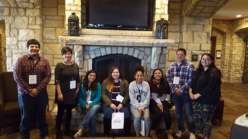
KansasView provided sponsorship funding for the conference to offer complimentary registration to students from Haskell Indian Nations University. Thirteen students and one professor from Haskell participated in the conference. Dr. Stephanie Willis, who teaches Advanced GIS at Haskell, and 12 of her students gave presentations at a session devoted to showing how they are using GIS Story Maps to highlight Haskell’s history and environment. The students who presented included Janee Bates, Zechariah Johnson, Alyssiana Gonzales, Amanda Smith, Chebon Smith, Diamond Williams, Kayla Jackson, Kathy Littlebull, Josiah Candelaria, Adler Aspaas, Garrett Williams, and Braden Souders. In addition, Ian Gambill, a senior at Haskell, won first prize in the student poster competition. His title was “Characterizing Hyporheic Extent Using Electrical Resistivity and Concentration Breakthrough Curves.” His co-authors were Sawyer McFadden, and Kamini Singha.

Online Environmental Remote Sensing Course at KU Edwards Campus
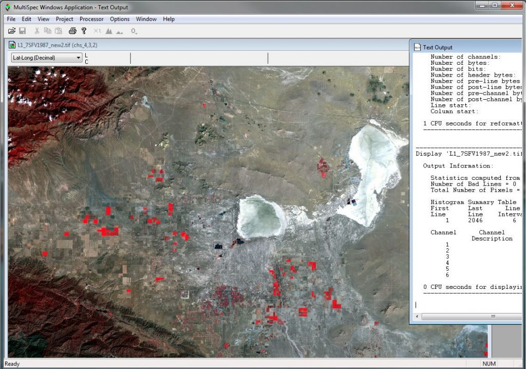
Fifteen students completed the 8-week online course, EVRN536/736: Environmental Remote Sensing at the University of Kansas Edwards Campus in Fall 2019. The online course taught by KansasView coordinator, Dr. Dana Peterson, is part of the KU Edwards Environmental Studies Program, which offers both undergraduate and Professional Science Masters degrees. The course utilized MultiSpec software that is developed and maintained by Purdue University and is supported by AmericaView. The freely available MultiSpec image processing software benefited the course and students by allowing students to complete labs remotely on their individual computers. The course will be offered annually or biannually. For more information about our partner institution, including programs and course offerings visit https://edwardscampus.ku.edu. To access MultiSpec software visit https://engineering.purdue.edu/~biehl/MultiSpec/
Ecology Seminar on UAS Drone Technology
On November 22, 2019, Dr. Steve Egbert, PI of KansasView, introduced drone technology to faculty and students from the KU’s Department of Ecology & Evolutionary Biology and staff from the Kansas Biological Survey as a seminar for the Ecology Seminar Series. Egbert’s seminar covered basic flight rules, flight planning and operations, and potential mapping applications. Following the seminar, students practiced flying a DJI Phantom 4 Pro drone in a nearby area.